
Storm towards Sardinia: the red alert is triggered for storms, wind over 100 km/h and snow at high altitudes
The situation for the island worsens: maximum criticality in the western sectors. Waves seven meters high are also possible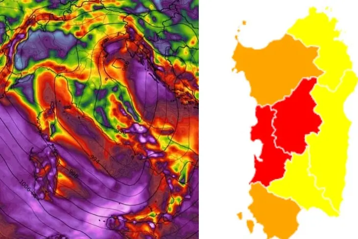
Per restare aggiornato entra nel nostro canale Whatsapp
The picture of the weather forecast for Sardinia worsens: violent storms and winds are expected with storm intensity between today's evening, Monday 21 November, and tomorrow's.
The regional civil protection has issued a new alert bulletin that goes from yellow to red: the criticality is high for the western sectors.
In detail, the areas in which the most intense phenomena are expected, with a red hydrogeological and hydraulic risk code, are the Oristano area, then the entire Tirso area, part of the Nuoro area and the Montevecchio Pischinappiu area. Orange alert instead in Sulcis, in the upper Logudoro and in the Sassari area. Yellow for the rest of the island. Precipitation, in the most exposed areas, could reach 100 millimeters.
Not only storms are expected. The winds, which will rotate from the southwest to the northwest, could blow with gusts exceeding 100 kilometers per hour, with storm intensity. Expected waves up to seven meters high near the western coasts.
Snowfalls above 1400 meters are also expected tomorrow.


