
Mistral storm over Sardinia, the alert: "Extreme danger of fires"
The notice of the Civil Protection has been issued for Sunday: the wind will still increase in intensity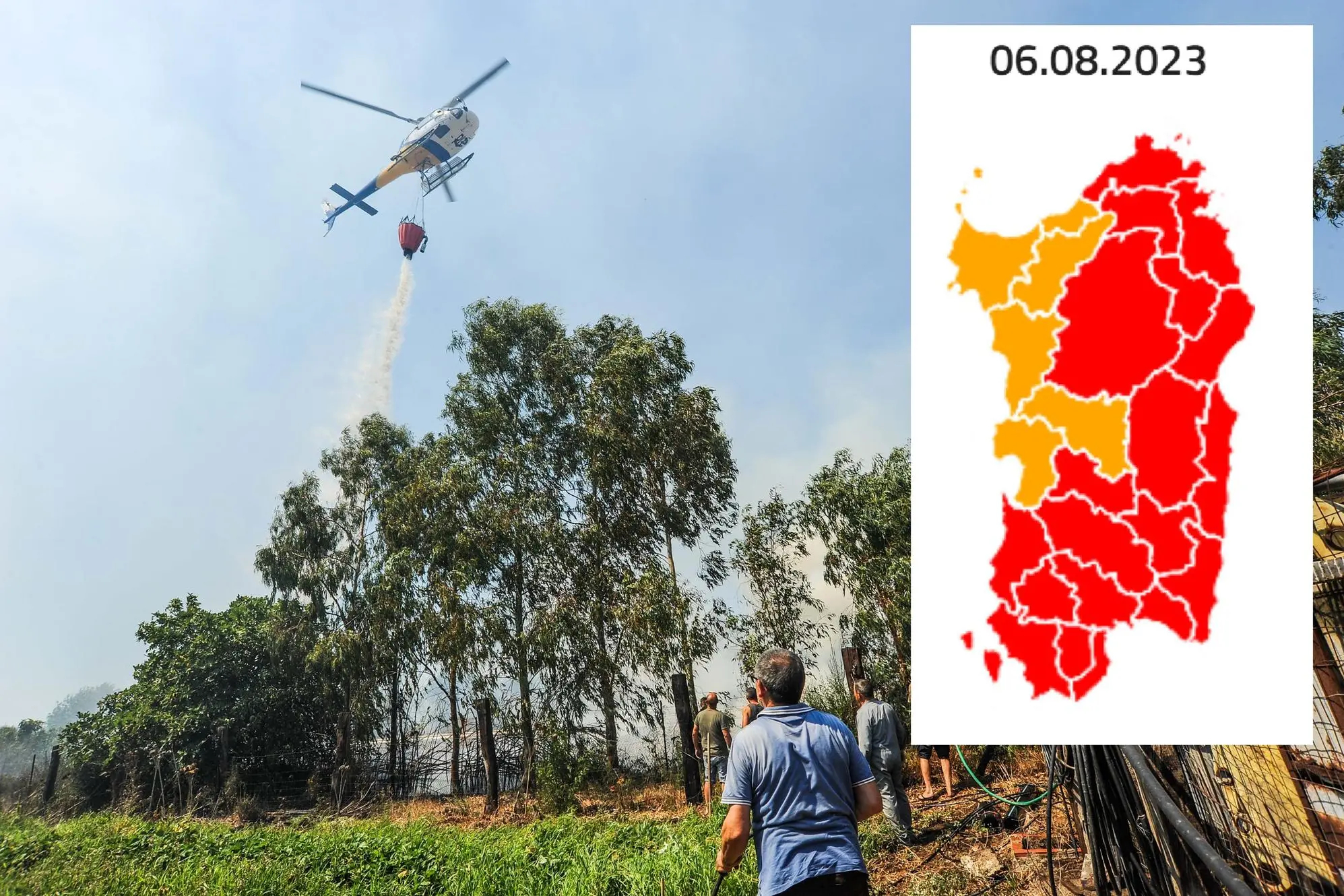
Per restare aggiornato entra nel nostro canale Whatsapp
The mistral storm that is hitting Sardinia in these hours shows no signs of losing intensity, with gusts hovering around 100 kilometers per hour.
The regional civil protection for tomorrow, Sunday 6 August, launches the alert on two fronts: that of adverse weather conditions, precisely due to wind and storm surges, and another for the danger of fires, classified at an extreme level.
«Until the early hours of Monday», reads a note issued by the Arpas weather center, «Sardinia will be affected by strong winds from the west-north-west with reinforcements up to a storm or strong storm on the eastern and southern coasts and on the reliefs. Possible storm surges on the exposed coasts.
On the firefighting front, the Civil Protection maps draw an island characterized by the red of maximum alert, which above all concerns the areas most swept by the mistral wind: the entire southern area, the eastern and north-eastern sectors.
In the code of the intervention system "extreme danger" means that "the conditions are such that, once the trigger has occurred, the event, if not promptly addressed, rapidly spreads reaching large dimensions despite the contribution of the state air force to the regional air fleet" .
Henry Fresu


