Grasshoppers, the emergency map: 32,804 hectares infested in Sardinia
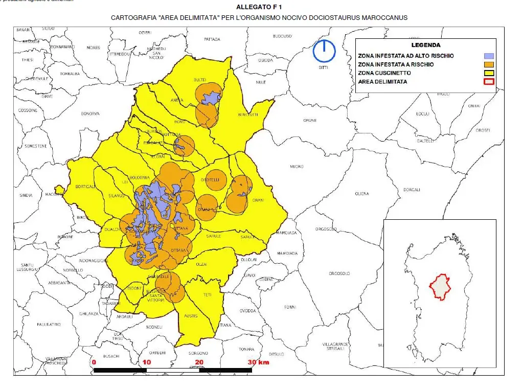
The Region delimits an area of 134,000 hectares affected by the phenomenon, to be kept under control in 2023: over 6,600 are classified as "high risk"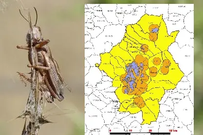
Per restare aggiornato entra nel nostro canale Whatsapp
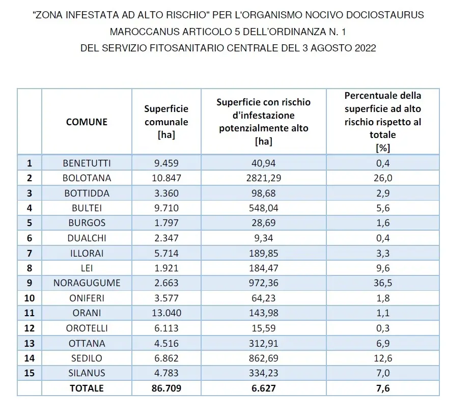
The infested area is 32,804 hectares large. Of these: 6,627 are classified as "high risk", while the other 26,177 are "only" at risk. An area defined as a "buffer" was delimited around it. And it is huge: 102,007 hectares. That is, the extension of the administrative borders of the municipalities which, if there is no preventive intervention, will soon be covered by billions of grasshoppers. A plague that has been affecting central Sardinia for years now.
The Regional Department of Agriculture has begun to move. While waiting for contrast measures before the eggs hatch, the "Sustainability and Quality of Agricultural and Food Production" service, with a document published today, February 9, has drawn the map of the territory considered in danger in 2023. The indications are arrived from the Department of Agriculture of the University of Sassari and the Laore agency, who worked in the field and identified the parameters for the evaluations.
The "delimited" area covers the territory of 26 Municipalities and is 134,000 hectares wide. Includes: Anela, Austis, Benetutti, Bidonì, Bolotana, Bono, Bortigali, Bottidda, Bultei, Burgos, Dualchi, Esporlatu, Illorai, Lei, Noragugume, Nughedi Santa Vittoria, Olzai, Oniferi, Orani, Orotelli, Ottana, Sarule, Sedilo, Silanus, Sorradile, Thetis.
The area declared "infested" is almost 33 thousand hectares and affects, for example, 88.18% of the territory of Noragugume (2348.17 hectares), 83.6% of that of Ottana (3775.2 hectares) and 62.14 of that of Oniferi (2,222 hectares).
There are 15 municipalities with spaces considered high risk, and they are listed in the table below.