
Severe weather in southern Sardinia: "Significant rainfall, with the heaviest activity at sea."
Orange alert until midnight, the disturbance will also bring thunderstorms to coastal areas in the next few hours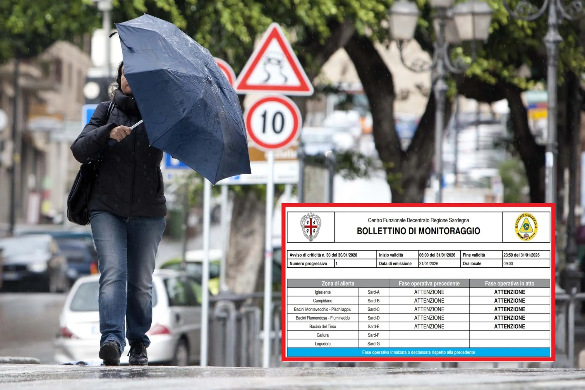
Per restare aggiornato entra nel nostro canale Whatsapp
Orange alert for the Cagliari area and Sulcis until midnight. While in the capital , Mayor Massimo Zedda has closed schools, parks, and public offices, "in the last six hours, significant rainfall has been recorded in central and southern Sardinia, ranging from scattered to widespread and of a mixed stratiform and thunderstorm nature, with light and locally moderate cumulative rainfall." This is according to the bulletin from the decentralized Civil Protection functional center monitoring the ongoing events.
The most significant readings – updated as of 9:00 a.m. on January 31 – were: Pula Is Cannoneris 32.2 mm, Diga Bau Pressiu 25.2 mm, Siliqua Campanasissa 18.8 mm, Diga Punta Gennarta 18.8 mm, Iglesias RF 16.8 mm, Santadi RF 16.2 mm, Castiadas 15 mm. Twelve other stations recorded values between 10 and 15 mm, approximately sixteen values between 5 and 10 mm, while the remaining rain gauges reported values that were not significant for civil protection purposes.
As for the dams, "no reports have been received in the last six hours."
The chart reports that "a low-pressure system closed at all levels over the British Isles extends to the coasts of North Africa. This system is associated with a trough, with a secondary low closed at land level between the Balearic Islands and Sardinia, moving eastward."
In the last three hours, "scattered rainfall is expected, including showers or isolated thunderstorms, with generally light cumulative rainfall in the central and southern areas, locally moderate in the Sulcis area. Isolated lightning strikes were observed in the Sarrabus area and over the Sardinian Sea and Channel."
For the next few hours, "predominantly stratiform precipitation is expected, with occasional showers in the southern regions, spreading to all western regions. The most intense convective activity will occur mainly at sea, with likely local involvement of southern coastal areas."
Enrico Fresu


