
Rain returns to Sardinia: forecast for Sunday
Weekend characterized by stable temperatures, without particular excesses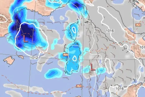
Per restare aggiornato entra nel nostro canale Whatsapp
Rain could return to Sardinia in the middle of summer. This is what weather models predict for Sunday, following a week of falling temperatures following a long period of African heat caused by the anticyclone.
A small disturbance is arriving on Sunday, potentially causing increased instability and scattered showers from Sardinia. Starting Monday, a possible increase in pressure could bring the first tentative signs of African heat to southern Italy , which will gradually extend toward central and northern Italy by mid-next week.
Specifically, precipitation is expected to begin during the night between Saturday and Sunday in various areas of the island, following an increase in cloud cover starting Saturday evening, with rain expected to continue into the early hours of the morning . Subsequently, the warning will particularly affect the eastern part of Sardinia. By the afternoon, the brief passage of the low-pressure system should have concluded.
Regarding temperatures, after the very high minimums recorded in recent days , today the trend seen throughout the week is expected to continue, with highs generally around 30°C and 20°C or slightly lower at night . The ARPAS (Italian National Aeronautics and Space Administration) reports stable or slightly rising temperatures for both tomorrow and Saturday.
(Unioneonline)


