
Retreating anticyclone, thunderstorms with hail from Tuesday
But next weekend promises to be warm and sunny again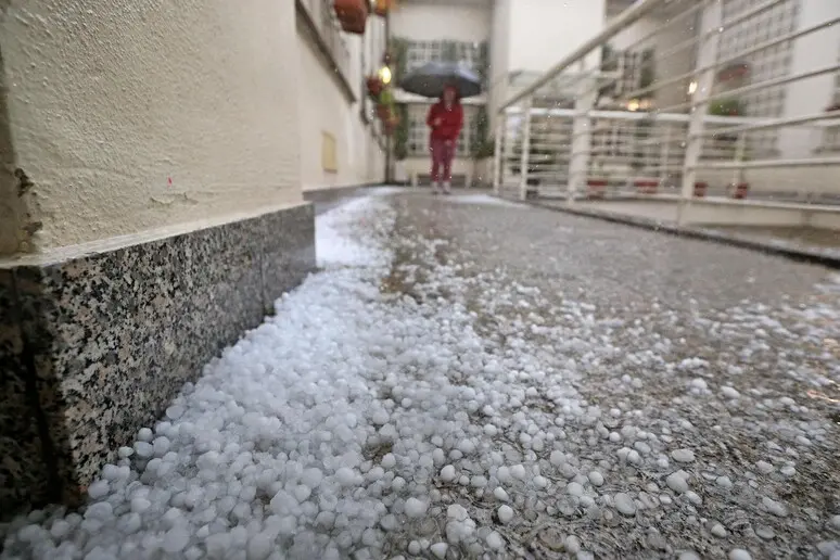
Per restare aggiornato entra nel nostro canale Whatsapp
Today, Monday, is the last day - and also the warmest - of the anticyclone Narcissus. In fact, a large storm phenomenon is expected after a period of atmospheric stability and mild climate.
The weather will worsen towards the evening and then during the night in the North.
From tomorrow, Antonio Sanò of iLMeteo.it anticipates, an Atlantic disturbance, driven by a cyclonic vortex forming over the Ligurian Sea, will impact the northern regions causing a gradual worsening starting from Val d'Aosta and Piedmont where the first rainfall is expected. The rest of the North will remain on hold, as will Tuscany.
On Wednesday the disturbance will affect the North with greater intensity with thunderstorms, possible hailstorms and strong gusts of wind which will strongly affect Lombardy in particular, including Milan, but generally many areas of the Po Valley. Precipitation will also affect Emilia, the Dolomites and western Veneto (especially the Garda area). Clouds increasing over the rest of Italy, but without particular phenomena except for some in Tuscany and Sardinia.
Very quickly the vortex from the Ligurian Sea will descend towards Sardinia and therefore North Africa, also losing energy, therefore from Thursday the 11th the weather will improve again. A rather warm high pressure field will arrive again and so in addition to the prevailing good weather, from Friday temperatures are destined to rise significantly in all regions with maximum values once again above the average for the period. We therefore expect another weekend (that of 13 and 14 April) very sunny and decidedly warmer than this one just gone by.
(Unioneonline/ss)


