
The Befana cyclone arrives: rain and winds of up to 100 km per hour in Sardinia, snow in the mountains
Temperatures down by 4-5 degrees, some light hailstorms are also expected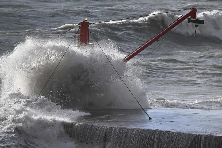
Per restare aggiornato entra nel nostro canale Whatsapp
The Epiphany cyclone is ready to hit Italy and Sardinia. In the space of a few hours we go from a mild and sunny autumn queue to the cold winter. And after the rain and the strong wind, the polar freeze will also arrive from Sunday.
This was confirmed by the experts from the Decimomannu Air Force weather office. «An arctic air mass of maritime extraction has arrived in the western Mediterranean which is triggering a decisive change in the climatic situation - they explain -. Today we find a temporary lift of clouds which will bring scattered rainfall in the western and northern sectors of the island with temperatures even higher than the seasonal average".
But from tomorrow the situation will worsen rapidly with overcast or very cloudy skies and rain in the western, northern and then central sectors with a significant strengthening of the wind. «During the morning it will change to mistral and will strengthen significantly - the experts specify - with winds that will blow on the coasts between 50 and 70 kilometers per hour with peaks of 100 kilometers on the exposed areas».
This situation will bring freezing air to Sardinia with a drop in temperatures of four-five degrees: the maximum temperature will go from 17 degrees to 12-13 degrees, while the minimum temperatures will be around 7-8 degrees with a few degrees less in the internal areas and mountainous.
The rains will not be abundant: «It will rain in the western and northern sectors with cumulative amounts of around 20 millimeters tomorrow, while in the southern sectors it will reach around 5-6 millimetres. To make a comparison, around 600 millimeters of rain falls in a year."
Snow is also expected in the mountains on the night between Saturday 6th and Sunday 7th. On Monday, more thunderstorms, rain and some light hailstorms, the phenomena will ease between Tuesday 9th and Wednesday 10th, but the bad weather will return shortly.
(Unioneonline/L)


