
Storm gusts and storm surges, new weather alert issued in Sardinia
Throughout the day on Tuesday 17th a strong mistral wind will hit the island, with waves over 4 metres high on the western and northern coasts.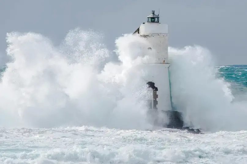
(Handle)
Per restare aggiornato entra nel nostro canale Whatsapp
Strong winds and rough seas are expected in Sardinia throughout tomorrow, Tuesday, February 17, starting in the very early hours of the morning.
Yet another Civil Protection alert. A promontory of high pressure over the Iberian Peninsula and a low pressure system moving across the Adriatic are causing a "strong pressure gradient over the western Mediterranean," the bulletin states, which "will give rise to intense northwesterly currents, intensifying starting from the night between Monday, February 16th and Tuesday, February 17th ."
From 7 a.m. until 9 p.m. on Tuesday, strong mistral winds will blow across Sardinia, with local and temporary reinforcements reaching gale force strength , more likely during the first part of the day. The winds will ease in the afternoon, but will remain strong until late evening. For this reason, the western and northern coasts of the island will be affected by a northwesterly storm surge , expected to peak on Tuesday morning with waves over 4 meters and average periods exceeding 7 seconds .
Isolated showers are also expected, but they are not cause for concern. No flood or hydrogeological warnings have been issued.
(Unioneonline)


 for days: the desperation of a woman in Quartu")


