
Rain, thunderstorms and storm surges: new bad weather alert on the island
For two days Sardinia will be affected by strong perturbations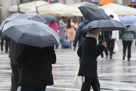
Per restare aggiornato entra nel nostro canale Whatsapp
Still bad weather in Sardinia .
Rain, thunderstorms, wind and storm surges are arriving in the next few hours.
The Regional Civil Protection has issued a new alert, valid from 3 pm tomorrow, Monday 21 November, until midday Tuesday 22, with yellow code (ordinary criticality) due to hydrogeological risk in the areas of Iglesiente, Campidano and Gallura; always yellow code for hydraulic and hydrogeological risk in the areas of Montevecchio Pischinappiu, Tirso and Logudoro.
“Sardinia - reads the bulletin - will be affected by scattered to widespread rainfall, even in the nature of scattered showers or thunderstorms. The cumulative can be punctually raised on the western sectors and on the mountainous areas".
From 8pm always on Monday and until midnight on Tuesday 22 November, however, there will be a progressive increase in windiness .
The winds "will blow from the South-West up to a storm" tomorrow and "will rotate from the North-West" on Tuesday, "with intensity up to a storm with storm gusts on the coasts and on the ridges: the phenomenon will mainly affect the west coast and the north coast of the island".
The Sea of Sardinia and the Bocche di Bonifacio «will have a progressively increasing wave motion, resulting in very agitated or large western quadrants. Sea storms starting late tomorrow evening: the phenomenon will initially affect the coasts exposed to the South-West and subsequently those exposed to the North-West".
(Unioneonline/D)


