
Nuscara, the new trail network of the Villanova municipalities is born.
The routes will be registered in the appropriate register and equipped to allow hiking and tourism use of the green areas.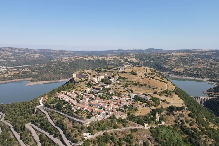
Per restare aggiornato entra nel nostro canale Whatsapp
The "Nùrcara" trail network, launched in the Villanova Union of Municipalities, will immediately provide over thirty-one kilometers of medium-distance itineraries, connecting thematic areas of exceptional environmental, naturalistic, religious, historical, and archaeological value. The scenic beauty of the griffon vulture and golden eagle trails is also worthy of note.
Despite the ever-increasing depopulation process, the area's development potential has led to the development of an intermunicipal strategic development plan, with the creation of a sustainable tourism reception system that, through the creation of a network of hiking trails, can tell the story of and promote the area and its important thematic resources.
"The trail network aims to become a major attraction, not only regionally, but also nationally and internationally, in the context of the demand for slow hiking tourism," stated the Union's president, Giovannina Fresi . "The inclusion of our trails in the network promoted by the Region will certainly boost the project's international reach, and to this end, an important collaboration has been initiated with the Forestas agency and the Italian Alpine Club (CAI)."
The project, developed with the assistance of expert Matteo Cara and planned by architect Federica Rubattu, was approved by mayors Quirico Meloni, Paolo Chessa, Alessandro Mura, Lucia Catte, and Giovannina Fresi herself. The new trails, identified within the municipalities of Villanova Monteleone, Mara, Padria, Romana, and Monteleone Rocca Doria, will be connected to those of Forestas and the CAI ( Italian Alpine Club) and will be registered in the Sardinia Region's land registry. They are perfectly equipped to allow hiking and tourism in the green areas connecting towns, monuments, and archaeological sites.
The interventions include maintenance, cutting down invasive vegetation, restoring dry stone walls and fences, and installing red and white horizontal road signs and dedicated signs.
The first route starts in Villanova Monteleone and extends for sixteen kilometers, following local roads, connecting the town to the archaeological site of Nuraghe Appiu and the nearby SP19. It continues towards Monte Minerva until it joins a RES route to Locanda Minerva and the area's historical and archaeological sites. The second route, just over seven kilometers long, runs through the Padria area and connects the town to the nuraghe and the medieval settlement of San Saturnino, near which the now-extinct village of Musidanu also stood. The third route extends for almost five kilometers along rural roads, connecting the town of Mara with the Church of Nostra Signora di Bonu Ighinu, passing a short distance from Bonvehi Castle, and finally reaching the Sanctuary of Nostra Signora di Bonu Ighinu. The fourth trail extends for three and a half kilometers from the foot of Monteleone Rocca Doria, passing near the ancient washhouse and circling the foot of the fortress. It allows you to visit the scenic abandoned and redeveloped tuff quarries, connecting to the climbing walls, where the famous “Ferrata della Regina” is located.
A fifth project concerns the ancient path that connects Monteleone to Romana through the valleys of the Temo, its tributaries, and the Neolithic tomb of Monte Airadu, and will soon be fully accessible.


 has surpassed 3,000 employees: future investments in hospitals and the local area are on the horizon.")


