
The discoveries on the Roman Bridge: a defense against the floods of the Rio Mannu
For the implementation of the entire project to enhance the entire Rio Mannu area, the estimated costs are equal to 12 million euros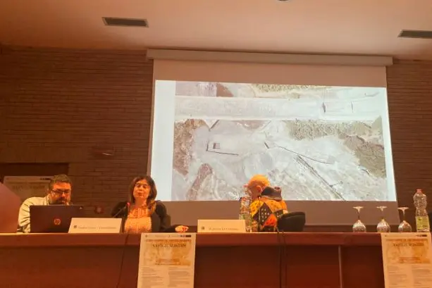
Per restare aggiornato entra nel nostro canale Whatsapp
A city wall or structures somehow connected to the channeling of the river, therefore to the protection of the ancient city of Turris from the flooding and power of the Rio Mannu.
These are the first hypotheses that the archaeological official of the Superintendence, Nadia Canu together with the archaeologist Luca Sanna, in their speech during the conference in Porto Torres entitled "Navigum Isidis: oriental cults in Turris Libisonis between port development and cultural exchanges", have put forward compared to the latest archaeological excavations on the eastern bank of the river, near the Roman Bridge. A preventive excavation test aimed at the construction of the Fluvial Pit, the project on the "Hydraulic defense works against the flooding of the Mannu river in Porto Torres", for which funds of approximately 6.4 million had been allocated by the Region.
For the implementation of the entire project to enhance the entire Rio Mannu area, the estimated costs are equal to 12 million euros. The plan started in 2010 thanks to the archaeologist Antonietta Boninu, has finally entered the operational phases in 2022 with the first archaeological surveys. The new research has confirmed that the ancient road plan proceeds on the mainland directly on the rocky surface, with an arrangement which where preserved presents pebbles bound with mortar, continuing to lower and then rise significantly after about 20 metres. «We started in 2022 with the first excavation test», explains Nadia Canu, who takes care of the scientific direction of the project, «on the basis of the investigations carried out with the georadar by Gaetano Ranieri of the University of Cagliari, who had highlighted various anomalies in depth". By virtue of this documentation, the Municipality of Porto Torres and the Superintendency have agreed to start seven excavation tests, each measuring ten by ten square metres.
«So we began the first essay following the anomalies reported by Professor Ranieri. But all the tests carried out both in the north and in the south have been a failure. So we decided to change strategy and also trust our intuition. In this phase we discovered an emerged linear structure about thirty meters below the bridge. The first hypothesis is that it was connected with the city walls hypothesized by Enrico Petruzzi in 2018, who had defined the course of the walls up to the mouth of the bridge". City walls or structure capable of channeling the waters of the river or, again, docks? The next archaeological investigations will resume in mid-March. «On the interpretations of the discoveries, I believe we will soon understand what it is about», explains Luca Sanna, coordinator of the works «but on the hypothesis of the function of safeguarding the city with respect to river floods, we can see, from some simulations, how this structure came to light, it could somehow channel the water under the arches of the bridge."
The infrastructure today lacks two rows, so originally it must have been about 60 meters higher. In case the flood was even greater, the lower part of the bridge acted as a canal, with a rise. The bridge in its nineteenth-century configuration acted as a dam and therefore carried the water towards the city. «The river Pit project does nothing more than restore the Roman-era plan - observes Sanna - slightly higher to protect the stretch of road, but nothing more than the rediscovery of the Pit from almost two thousand years ago». The structure discovered, therefore, would have had a very specific function: that of channeling the water under the arches of the Roman Bridge and, in the event of a major flood, allowing these constructions to be overcome to use the lower part of the bridge as a canal. to support flood maintenance away from the city, a structure that appears waterproofed due to the presence of a layer of mortar. "To better understand a triangular area will be investigated, to evaluate the stratigraphic deposit downstream and any chronologies upstream which we hope will provide some more answers."
