
La Pelosa, the cause of beach erosion discovered
A team of researchers, through a new survey model, has managed to establish why the "pearl" of the Stintino coast gradually loses its sand: the wind has something to do with it, but not only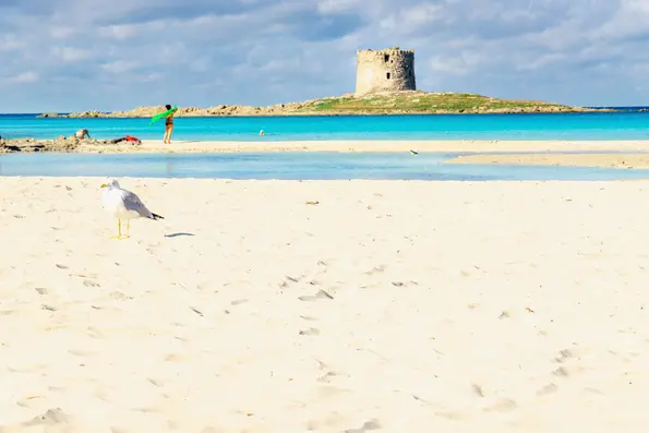
La Pelosa (Ansa)
Per restare aggiornato entra nel nostro canale Whatsapp
An innovative model to understand marine circulation, the evolution of beaches and investigate the causes of coastal erosion, especially in the Mediterranean Sea. It is the one developed by a team of researchers from the Cnr, the University of Sassari and Cagliari and Enea and which has made it possible to clarify the cause of the erosion of La Pelosa di Stintino beach, «increasingly affected by the effects of climate change and, in recent 30 years, from a growing erosion».
THE CAUSES - The researchers - who published a study in the prestigious international journal "Geological Society Publications" just on the eve of the European Day of the Sea, which is celebrated on May 20 - concentrated their investigations on the Asinelli Strait , which separates the sea of Sardinia from the Gulf of Asinara, "whose seabed is characterized by a complex and intertwined distribution of rocks, sand, Posidonia oceanica meadows and changing underwater dune systems". And they have, in fact, ascertained the reasons for the changes that have been affecting La Pelosa for years, one of Sardinia's symbolic places at a naturalistic level: «In practice – the experts explain – its extension and its shape vary according to the raising of the level of the sea, to the underwater meadow of Posidonia, but also to the regime of the winds. The latter can generate the loss of sand from the beach when the grains are transported westwards, towards a gully which causes them to deposit at a depth of 15-30 m, from where they are then unable to go back up» .
Thanks to the methodological approach implemented, the researchers were therefore able to reconstruct the real "evolutionary history" of this very particular environment and will be able to contribute to the environmental requalification of the Stintino beach-dune system.
THE MODEL – «The peculiarity of the model developed by the researchers – it is explained – lies in the fact that it combines wind and wave motion analyses, underwater surveys, sensors, aerial photo interpretations, but also seabed scans with geophysical surveys (such as Side Scan Sonar, Sub Bottom Profiler and Multi Beam) and implementation of high resolution numerical models. In addition to understanding the behavior of marine straits, real "waterways" that connect different basins, the model also allows to study the circulation of sediments in conditions of low tidal oscillations where the wind regime, effect of climate change, is primarily responsible for environmental dynamics.
THE EXPERTS – «Understanding the straits and connections between different basins is fundamental for current sedimentary depositional systems, for regional geological reconstructions and for large-scale and long-term tectonic and palaeogeographic evolution», explains Stefano Andreucci of the University of Cagliari , first author of the work.
«Understanding the processes affecting the strait between Sardinia and the island of Asinara - , highlights Vincenzo Pascucci of the University of Sassari - is not only important for the interest and economic value of the Stintino beach, but it is useful also for the completion of the Geological Sheet of the area that is being completed. For this reason, our university has invested considerable human and economic resources in the last twenty years to acquire data in the context of various research projects which have made it possible to collect a lot of information in the study area".


