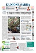
Industrial zones and old mines: in Sardinia thousands of hectares contaminated, no remediation
The Ministry of the Environment's report: on the island there are poisoned areas larger than 4 thousand football fields but no clean-up interventionsPer restare aggiornato entra nel nostro canale Whatsapp
The delimitation is there, the remediation is not. Or if it has been done, it concerns only a minimal part of the areas of Sardinia that have been included among the sites of national interest. That is, large portions of territory identified by law "on the basis of characteristics (of contamination and not only) that involve a high health and ecological risk due to the density of the population or the extension of the site itself, as well as a significant socio-economic impact and a risk for assets of historical-cultural interest". And that must be "investigated", therefore analyzed to understand what is underground or in the aquifer, and cleaned of pollution.
There are two on the Island: the Sulcis-Iglesiente-Guspinese Sin, dotted with abandoned mines and industries (some in collapse) and that of Porto Torres. The latest report from the Ministry of the Environment crystallizes the situation in June. But since then little, very little, has changed.
In the southern Sin, 10,639 hectares of industrial areas and 9,112 of mining areas have been delineated. On the front of soil pollution, over 3,539 have not yet been scanned, mostly in the Macchiareddu area. Translated: the documents do not show how much and if they are polluted. Even if the probability is very high. On 1,457 hectares, the characterization plans (necessary to understand how to intervene) have been approved but have not been carried out.
The potentially contaminated areas, with concentrations of poisons above the risk thresholds, are 415 hectares. While those certainly contaminated, indicated with a red “alert” on the maps, are 2869 hectares wide: the Portovesme area is all this color. The approved remediation projects – after a long process – are valid for 893 hectares. How much has been remediated so far? 128 certified hectares, says the Mase. A handkerchief.
Enrico Fresu
