
Fires in Montiferru, a degree thesis and a project to avoid new disasters
The work of the students Francesco Gallittu and Giuseppina Pintus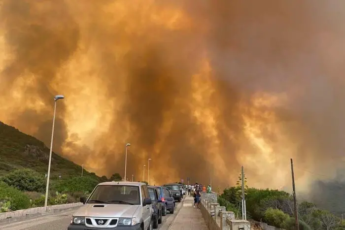
Per restare aggiornato entra nel nostro canale Whatsapp
A thesis on the stake that struck Santu Lussurgiu and the countryside of central Sardinia last summer, and a new project by the University of Cagliari born from the scientific collaboration between the professors of the University's chemical and geological sciences department with the Protection civil. Objective: to identify the areas most at risk of natural disasters due to the loss of forest heritage following the fires.
The work is by the students Francesco Gallittu (originally from Iglesias) and Giuseppina Pintus (Seneghe), supervisor Stefania Da Pelo.
"The first consideration - underline the new doctors Gallittu and Pintus - concerned the considerable effects of fires on the territory. consequent effects of erosion and instability that can occur on the slopes ".
A key aspect emerged from the research: the analysis of the territories is decisive. These were the premises that led to the collaboration between the Department, the Regional Order of Geologists and Civil Protection.
"A group of volunteers of the Order, chaired by Davide Boneddu, worked alongside the Civil Protection and the affected municipalities - explains Professor Da Pelo - The goal? Identify the critical areas that could have manifested phenomena of instability . first rains forecasts have been confirmed, with widespread erosion and instability phenomena, fortunately of low and medium intensity ".
The general director Antonio Pasquale Belloi and geologists Stefano Loddo and Vittorio Uras , and a delegation of the national and regional council of the Order of geologists , took part in the presentation of the research results, later collected in the thesis.
"We found the criticalities of the planning tools that apply methods of assessing susceptibility in a static way, taking a picture of the situation updated at the time of the drafting of the cartography - continues Da Pelo - The cartographic tools are tools that require continuous updates for the intrinsic characteristic of natural systems to evolve over time. The study conducted by the students with my supervision has shown that it is possible to build dynamic models for the assessment of susceptibility, considering the possible scenarios following changes in the territory, such as those caused by fires ".
(Unioneonline / vl)
